Case Study: Advanced mobile mapping services using Teledyne IIS spherical imaging solution
AnkaGeo uses Teledyne FLIR IIS’s Ladybug6 in its mobile mapping system to create advanced three-dimensional maps.
“Ankageo's goal from the beginning has been to provide advanced mapping services. Today, our services include three-dimensional maps, city guides, digital twins/3D modeling, traffic monitoring, and smart city management systems. The benefits go far beyond navigation and urban experience, because in an earthquake-prone country like Turkey, we can support authorities in disaster management, and detection of illegally constructed and potentially life-threatening building structures. Teledyne IIS's Ladybug6 plays a crucial role in our solution.”
- Hüseyin Kurşun, Managing Partner at AnkaGeo
Introduction
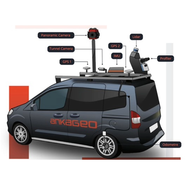
AnkaGeo, a Turkish based organization founded in 2009 specializes in advanced mobile mapping services. They have developed a Mobile Mapping System (MMS) that uses a combination of state-of-the-art sensors such as a powerful lidar system, a high-resolution laser scanner, GPS, an odometer, and as a core element - the Ladybug6 to generate high-resolution 360° images. The collected data from these sensors is then combined and processed using their in-house mobile mapping software to create three-dimensional maps.

Figure 1: AnkaGeo's Mobile Mapping System (MMS) combines a lidar system, a high-resolution laser scanner, GPS, an odometer, and Teledyne FLIR IIS’s Ladybug6 camera
Customers and Services
AnkaGeo's customers include government agencies, municipalities, and private agencies.
They offer services such as:
- Creation of three-dimensional maps for navigation purposes
- City guides
- Digital 3D city modelling
- Smart city management
- Illegal structure detection
- Disaster management
In addition, their service offerings include:
- Infrastructure investment tracking systems – To transparently organize and synchronize project and asset management systems.
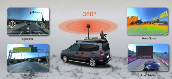
- Traffic control systems – For live recording of the traffic situation, control of traffic signaling systems, and counting and classifying vehicles, pedestrians, and cyclists.

Figure 2: AnkaGeo's Mobile Mapping System (MMS) records traffic signs, traffic lights and the road profile and simultaneously generates a point cloud
Challenge: Generating and synchronizing with highest possible image resolution
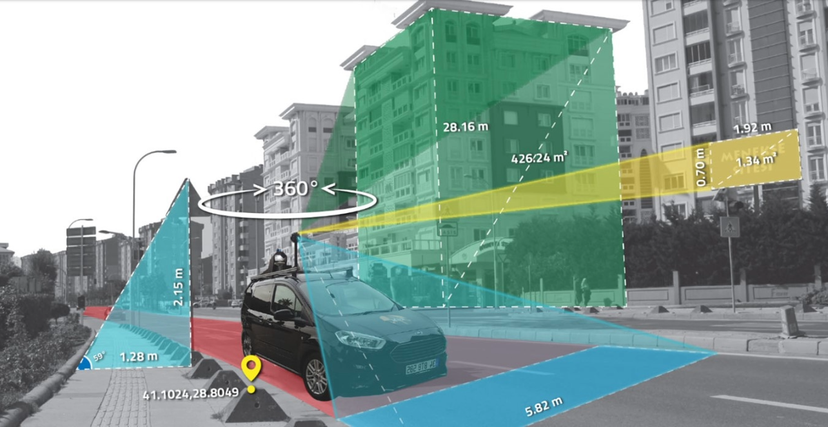
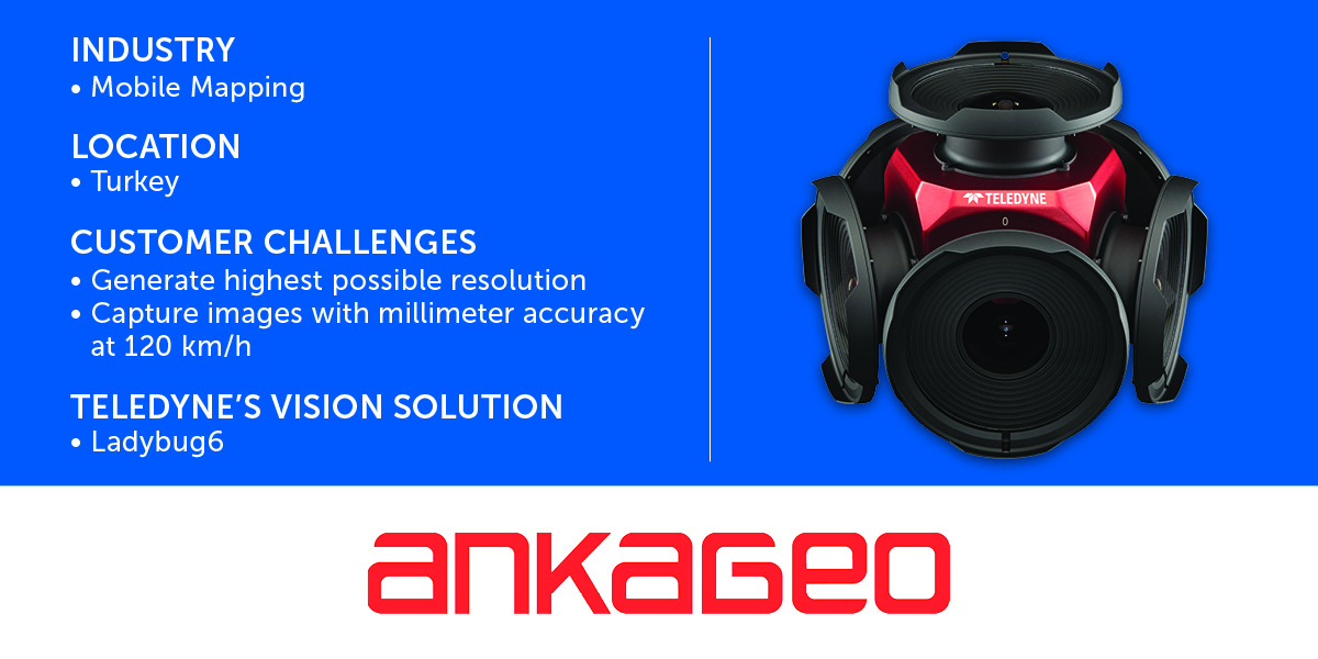
The biggest challenge in developing the MMS was to generate and synchronize the highest possible resolution data by capturing 72MP panoramic images, supplemented by laser and lidar data, leading to a 2,600,000-point cloud. The data generation needed to function with millimeter (mm) accuracy at a speed of up to 120 km. AnkaGeo wanted a system that generated the highest quality 360° images, was reliable and easy to use, offered versatile functionalities, and was cost-effective.
Solution: From the outset, AnkaGeo relied on the Ladybug6 camera system
“We use the Teledyne FLIR IIS Ladybug6 camera because of its exceptional features: Ladybug delivers first-class image quality, which is crucial for our needs. It also offers versatile features, especially for capturing panoramic images. Ladybug6 is reliable, very user-friendly, and intuitive, which makes it easy for us to integrate the camera into our workflow and to operate effectively. And finally: despite its premium quality, the Ladybug6 camera offers excellent value for money.”
- Hüseyin Kurşun, Managing Director and Owner of AnkaGeo
They combine Ladybug6's high-resolution 360° images with Lidar, GPS, and other information.
The following sensor systems were used in the development of the MMS:
- The Velodyne lidar system with 32 channels and a range of up to 200m
- A laser scanner (z+f profiler 9020) with a range of more than 180m, and scanning speed of more than 1 million dots/sec

Figure 3: AnkaGeo's Mobile Mapping System (MMS) uses Ladybug6 from Teledyne FLIR IIS to generate high-resolution 360° images
Results
Since the development of MMS, AnkGeo has undertaken several important projects.
The Istanbul panoramic image capturing was implemented back in 2013, followed by other projects throughout Turkey such as the Point of Interest (POI) project, traffic control systems with AI, and the 3D smart city management software.
By 2024, AnkaGeo covered more than 100,000 km throughout Turkey with its Mobile Mapping System (MMS), which is a real challenge in a mountainous country. They are expecting to cover another 10,000 km by end of this year.
The company has now taken on international projects that are ongoing in Azerbaijan.
